Terrestrial and Aerial Point Cloud Completion (TAPoC)
Motivation:
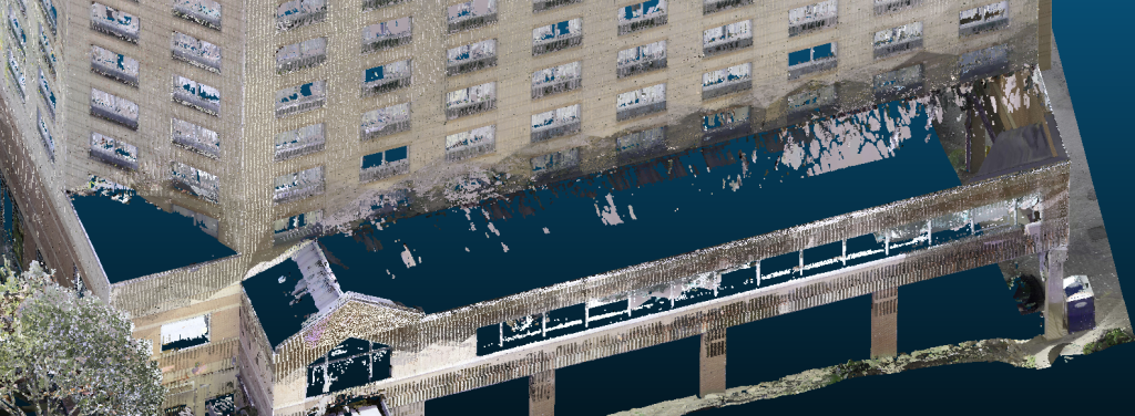
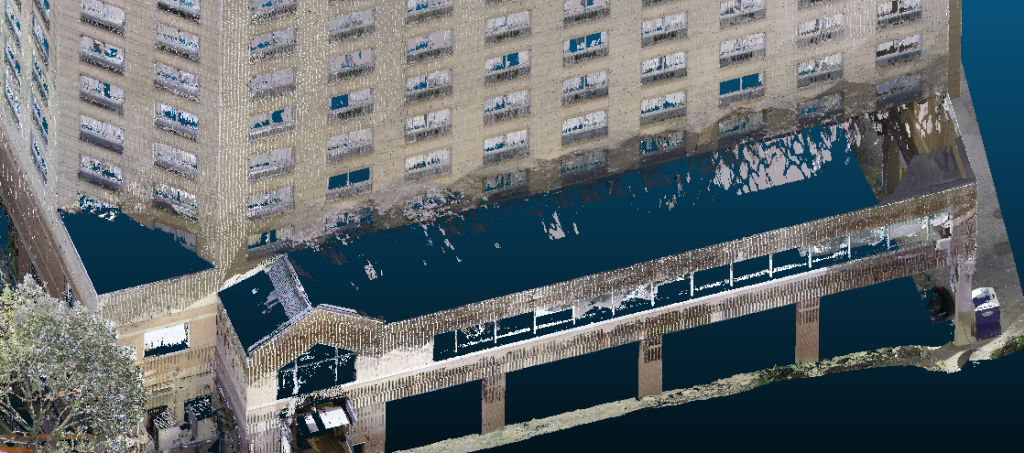
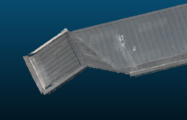
Terrestrial laser scanners can produce detailed, point-dense point clouds, but can’t fully capture surfaces that lie outside their line of sight from the ground, leaving holes and gaps in the point cloud, often near key details like window sills and window frames. As such, for terrestrial laser scanning projects, there is usually a need to capture the building not only from the ground level, but also from the balconies or rooftops of neighboring buildings. This is done to ensure that there is enough data to fill all of the gaps, shadows and holes in scans taken from the ground level. In addition, higher-up stories typically have a lower point density in scans taken from the ground level, making the subsequent scan-to-BIM conversion more error-prone.
Meanwhile, aerially captured point clouds from drones can capture complete building point clouds that include all of the surfaces that are inaccessible to terrestrial scanners, but these point clouds are noisier and less point-dense than terrestrial-captured point clouds.
TAPoC is an integrated software solution for rapidly and automatically filling the holes and gaps in terrestrial point clouds of buildings with points captured aerially. TAPoC speeds up the scan-to-BIM process, lowering the end-to-end cost of construction and remodeling projects.
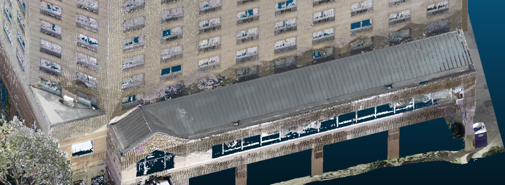
TAPoC lets you have the best of both worlds: its automated algorithms identify the holes and gaps in a terrestrial point cloud, extract the precise pieces of the corresponding aerial point cloud that are needed to fill the holes, clean and sharpen those pieces, and merge them into the terrestrial point cloud. The resulting completed point cloud includes more building surfaces and details than the original terrestrial point cloud, without unnecessarily polluting point-dense areas of the terrestrial point cloud with noise or extra points from the aerial point cloud. All the key data you need to derive accurate building dimensions and create models and shop drawings is seamlessly integrated into one file.
See how TAPoC can help you fill in missing data and replace expensive, time-consuming field measurements with an efficient, streamlined digital workflow for your next construction project:
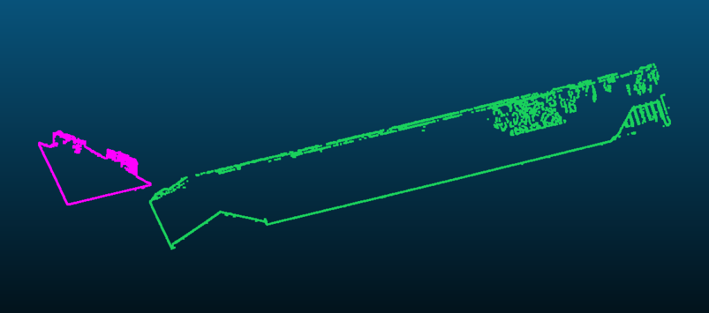
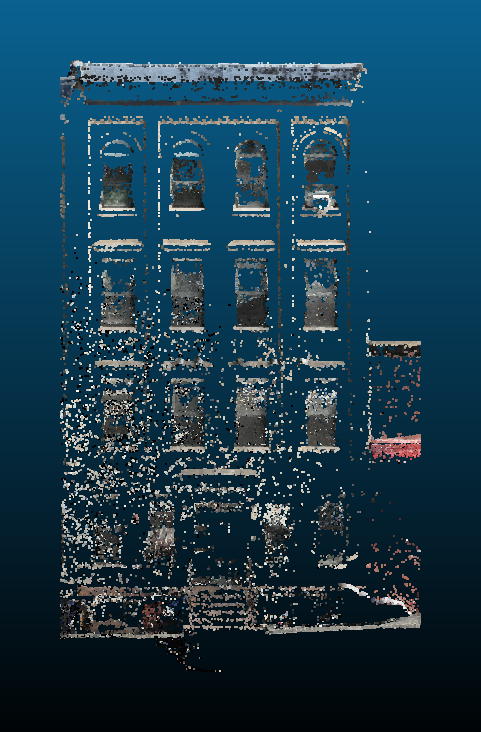
Standard Terrestrial Point Cloud

TAPoC-Completed Point Cloud
Standard Terrestrial Point Cloud

TAPoC-Completed Point Cloud

Fast, Automated Hole Detection
TAPoC detects holes and gaps automatically, so you can produce a high-quality completed point cloud quickly.
Touching up and refining the detected hole outlines is fast and easy with TAPoC’s intuitive editing tools, which let you trim, combine, split, and delete hole outlines with just a few clicks.
Terrestrial Point Cloud
Detected Hole Outlines
Easy, Precise Hole Filling
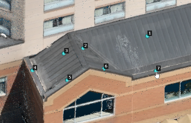
TAPoC can fill smaller or shallower holes completely automatically. For larger or deeper holes containing several different surfaces, all you need to do is click each surface that needs to be extracted from the aerial point cloud — TAPoC automatically analyzes the surfaces, detects their precise boundaries, and extracts them from the aerial point cloud.
TAPoC also gives you complete control over the extracted surfaces — you can interactively adjust their boundaries so that just the points you want are included in the completed point cloud.
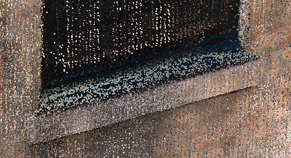
Holes in Terrestrial Point Cloud

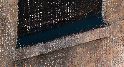
After Being Auto-Filled by TAPoC

Clicking Surfaces to Extract from Aerial Point Cloud
Extracted Surfaces
Purpose-Built Tools
TAPoC is purpose-built for completing point clouds, with precision that far outstrips ad-hoc completion approaches based on simple distance-based filtering and other generic algorithms. Only the exact points needed to fill holes are extracted from the aerial point cloud, with no noise or extra points introduced into the rest of the terrestrial point cloud.
Aerial Points for Completion
Using Existing Software
Aerial Points for Completion
Using TAPoC
Fits Into Any Workflow
TAPoC works with point clouds from any terrestrial laser scanner or drone-mounted LiDAR unit. Completed point clouds can be exported from TAPoC in the industry-standard E57 and LAS file formats, so they’re ready for use with any point cloud processing or building modeling software.
For more information about TAPoC, reach out to us at info@signetron.com.
We’d love to hear from you!